
Carolina North Forest (Horace Williams Tract) is a 947 acre wooded expanse owned by the State of North Carolina and the University of North Carolina at Chapel Hill.
CNF is managed by the University of North Carolina at Chapel Hill. There are two “sides” of Carolina North Forest, known as the “airport side” (East) and the “school side” (West), divided by Seawell School Road.
A Paradise for Bikers and Runners
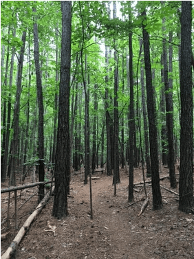
There are over 25 miles of single track and double track gravel trails in CNF. Several utility easements traverse the forest, creating additional gravel and varied surface paths. The trails are well-loved and used by hikers, mountain bikers, and trail runners year round.
CNF plays host to annual events, such as the Philosopher’s Way Trail Run each May, and ongoing activities such as trail running programs through Fleet Feet, meet-up rides through Triangle Off Road Cyclists (TORC), and orienteering training for orienteering clubs.
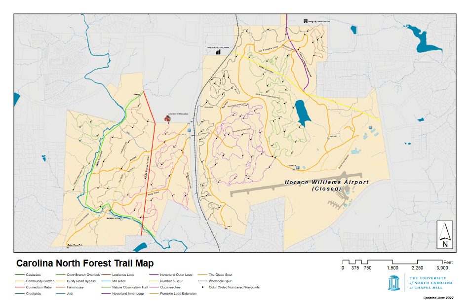
Downloadable maps are available on the UNC Facilities website.
All Trails names the Crow Branch Overlook Trail as one of the best birdwatching trails in the area. The odd geocache has been uncovered throughout the woods, as well (but we won’t spoil…).
The trails are managed by UNC Facilities Services, with help from volunteer groups such as the TORC and local Boy Scout troops. Before going, check the Facilities Services website to see if any of the trails are closed.
Pumpkin Loop; 2.3 miles of wide gravel
The Pumpkin Loop is a 2.3 mile wide gravel loop on the Airport side of Carolina North. There is an additional gravel service road called The Vine that connects the Pumpkin Loop to Seawell School Road. This is a popular walk for many, and the most accessible for those with younger children or groups who want to walk side by side and enjoy the space.
Airport side (EAST) single-track trails
- Neverland Inner and Outer Loop – These two trails wind around the woods just north of the airport. Ride or hike the Outer Loop to see the airport runway.
- Crow Branch Overlook – Crow Branch is a fun trail! There are some punchy climbs on Crow Branch, so its perhaps one of the more challenging trails in the CNF network. Take Crow Branch towards the east to walk or bike along a small pond, where there is a nice bench in case you need a breather after all of the fun.
- Wormhole – This is one of the longer trails at CNF, at close to 3 ½ miles. For mountain biking, Wormhole might be the flowiest, also.
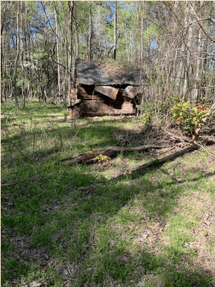
- Farmhouse – This is the shortest trail. But, there is an actual farmhouse! This trail also has some steeper grades, it’s worth noting.
School side (WEST) single-track trails
- Occoneechee Loop – Occoneechee is a nice 2+ mile loop that winds along Seawell School Road, across the gravel service roads and down the hill towards the Bolin Creek.
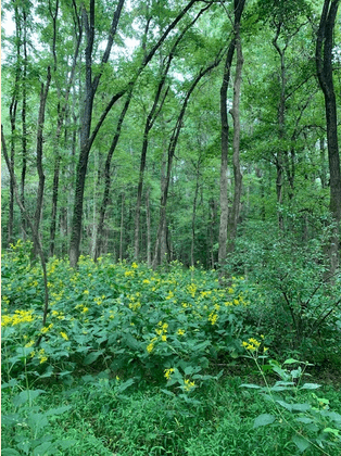
- The Glade – The Glade is one of the prettiest trails in CNF. In late summer it glows bright yellow with Goldenrod.
- No 5 – No 5 is sort of a connector trail – between the area near the Tripp Farm bridge and the top of the Duke Energy corridor where you can access two of the best downhills in CNF – the slalom section of Occoneechee, or Jedi.
- Jedi – Ride a bike down Jedi and you will understand the name! Oh you rode up it? Well, turn around! Down is better!
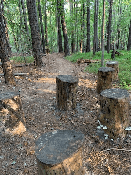
- Lowlands Loop – Lowlands has some very fun features if you are on a bike, and a little collection of tree stumps in a circle that can serve as a spot for a nice rest. The section of Lowlands north of Jedi is a little more challenging and hilly – south of Jedi is where you can get your wheels off the ground.
- Nature Observation Trail A & B – This trail is rated green on Trailforks, and it is one of the flowiest trails in the forest, more so than Wormhole. To access this trail you will need to cross the Bolin Creek, either at Tripp Farm, Rockgarden or behind Chapel Hill High School (and take the goat path…)
How to Access Carolina North Forest
The trails at CNF are not the easiest to navigate. There are wayfinding signposts where the singletrack trails meet the gravel, but there often isn’t wayfinding once you get into the single track. So, it’s helpful to have access to (a) a friend who knows their way around or (b) a map on your phone or on paper. This is the kiosk map of the entire Forest, and here is a GIS map. A map is also available on Trailforks, which lists mountain biking/hiking/walking trails. All of the trails at CNF are multi-use and bi-directional.
The trails do close after heavy rains. Trail status can be checked via the Facebook page or on the same Trailforks page listed above. It is very important to adhere to the trail closures, and not cause further damage to the trails when they are wet. The gravel roads (Pumpkin Loop, Maytag and Tripp Farm, along with the utility easements) are open when the single track is closed.
Carolina North has several formal access points, and several more informal ones. Here is a list of the most accessible trailheads.
For the school side, there are entrances at:
- Tripp Farm Road Tripp Farm Road dead ends into CNF.
- Rockgarden Road – Rockgarden Road is another dead end road with CNF access.
- From Winmore under Homestead Road – the greenway that connects the Winmore neighborhood, Claremont and Claremont South with CHHS, Smith Middle and Seawell Elementary, known as the Homestead-Chapel Hill High School Multi-Use Path, or Bolin Creek Greenway Phase1B, can be seen on this GIS map. The OWASA utility easement or single track can be accessed from this greenway.
- Seawell School Road – there are two sign posted entrances on Seawell School Road just south of Seawell School. Access gravel service roads from these entrances, then single track.
For the airport side
- Seawell School Road (the Vine) There is a signposted entrance leading onto the Vine, which is a gravel trail that connects to the Pumpkin Loop.
- Seawell School Road There is an unmarked entrance just across from Seawell Elemenary that will get you onto the Wormhole. You should be able to see the trail, and you’ll have to cross over the RR tracks.
- Municipal Drive (Locust lot) This is the formal parking lot for Carolina North. If you are driving be sure to use caution on the gravel road to this lot because many people walk, ride and run on that stretch of the road as well.
Where to park and bus to access Carolina North
The only formal parking for Carolina North is the Locust lot, which is accessible via Municipal Drive. Some off street parking is available along Seawell School Road, to access the Tripp Farm or Maytag gravel, or near the Vine entrance towards the south.
Transit riders can access CNF from the NS stop at MLK and Shadowood, or from the F route on the Carrboro side.