
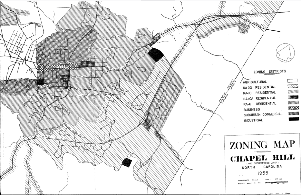
We were looking through old Chapel Hill Town Council meeting minutes when we came across the 1955 zoning map from the town. Prepared by the Planning Board, the map set up three additional districts in town: RA-20, suburban commercial, and agricultural.
What does the map show?
It shows Chapel Hill’s eight zoning districts. We can see lot sizes for what is now Downtown Chapel Hill, Forest Hills, Morgan Creek Glen Lennox, Pine Knolls, Northside and other neighborhoods.
You can see that the lot sizes were smaller in Pine Knolls, then called the Knolls Development, and Northside, neighborhoods that housed Black residents. Lot sizes were also smaller in the recently-constructed Glen Lennox development.
Glen Lennox and Pine Knolls were annexed by the Town of Chapel Hill at the same time. Both developments catered to WWII veterans and their families who were using their GI Bill to acquire home loans. Pine Knolls was created primarily to house Black service workers at UNC. Glen Lennox did not have explicit exclusionary covenants, but it was common knowledge that it was a whites-only neighborhood, something that realtors ensured.
We are examining the history of Chapel Hill’s covenants through our Chapel Hill inclusion project. To learn more or participate, fill out this simple form to let us know you’re interested and how to get in touch with you.