
Wilson Library at UNC is a treasure trove of documents related to the history of Chapel Hill and Carrboro. On one visit, we came across the Chapel Hill-Carrboro Transportation Plan from 1976, which we scanned – in full.
Written in March of 1976, the document talks about the formation of Estes Drive, Umstead Drive, Piney Mountain Road, and Seawell School Extension, which was then called SR 1843.
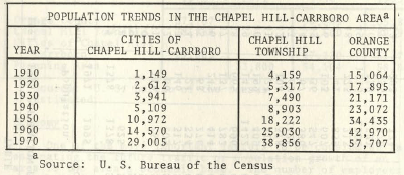
We can see how the population of Chapel Hill-Carrboro grew rapidly between 1960 and 1970.
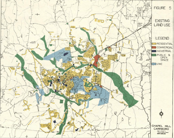
The plan also contains a land-use map:
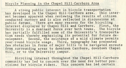
It’s a truly wonderful glimpse at how planners saw our region 50 years ago. And it shows that even then, there was a strong interest in safe and convenient biking routes around town.
You can download the entire transportation plan here. Enjoy!